11/19/2019
SUNY Cortland and Monroe Community College are working together to make sure that all New York state college students can pursue opportunities in the growing field of geospatial information science and technology (GIST).
Faculty members from the two SUNY schools recently teamed up to land a $54,000 New York state grant funding strategies to overcome barriers many students have in learning the state-of-the-art computer mapping software required for the discipline — which has projected double-digit job growth through 2024.
For SUNY Cortland, the initiative could greatly expand GIST students’ internship opportunities, strengthen the pipeline of transfer students in this field, create professional part-time employment for students and make working with complex geographic information software much more convenient for students.
It could also allow Cortland, which hosts the Institute for Geospatial and Drone Technology (IGDT), to offer fully online courses involving web mapping and data analytics that could eventually enroll students throughout the SUNY system.
“We’re talking about bringing a virtual server, a virtual desktop, to MCC, working with SUNY Cortland’s institute, but really using it through a kind of remote computer,” said Chris Badurek, a SUNY Cortland associate professor of geography and director of research for the Institute for Geospatial and Drone Technology.
“The technology aspect provides virtual access to software,” Badurek said. “For example, you can run software technology from your laptop that usually is only available in a lab setting.”
This is important for students at Monroe Community College in Rochester, who need more access to the computer software and person-to-person technical support, according to Jonathon Little, associate professor of GIST at MCC.
About a quarter of Monroe’s GIST students are struggling with the software, usually because their home computers aren’t able to support the geographic software and they must do all their work during hours when the campus learning center is open, Little said. MCC is primarily a school for commuting students who do not live on campus.
Both Cortland, a four-year Central New York university, and Monroe, a two-year institution, offer degrees that involve mastering geographic information systems (GIS) technology. Although its students often struggle with access and expertise related to the software, MCC is the only New York community college that offers a certificate in GIST.
Many of those certificate holders transfer to SUNY Cortland to pursue a four-year degree in the discipline, which largely involves analyzing the wealth of data collected by drones and satellites. Through this project, junior and senior GIS students at Cortland will serve as peer mentors and tutors for MCC students, improving their ability to succeed and perhaps transfer.
“MCC has a really good GIS program, so when the graduates come here, they have a solid foundation and they start out at a high level,” Badurek said, noting that many jump right into research projects that are featured at Transformations, Cortland’s annual celebration of scholarly and creative achievement.
Funding for the initiative is through the SUNY Innovation in Instructional Technology Grant (IITG) program.
The IITG grant — for a project called Open Geospatial Lab (OGL) and Remote Workforce Opportunities across Rural New York State — primarily will be used to install virtual access software that will let their students and others from institutions across SUNY tap into the GIS computer software.
The virtual server is going to be installed at MCC, where Little, a faculty member in MCC’s Chemistry and Geosciences Department, is leading the one-year pilot project for both institutions.
The funding also makes possible online support from both Cortland and MCC faculty and from experienced SUNY Cortland student tutors.
Badurek envisions that he and these paid research assistants will be holding virtual office hours outside regular daytime or weekday scheduling.
“There’s a real opportunity there for our students to provide support, but they are learning a lot and building their own skills,” Badurek said.
The project also aims to help enrolled GIS students burnish their resumes with actual professional experience from a wider geographic range for government-supported internships.
“For our students, this opens us up for paid work with organizations that are not in immediate proximity,” he said. For summer internships, the students need not even spend the term in Cortland.
“They will be able to work from their homes on Long Island if they wish.”
Both professors plan to use the new technology to expand the reach of service learning opportunities to outside the U.S.
Next spring, the funds additionally will support Badurek to design and teach a hybrid 50% online and 50% classroom course that involves web mapping and data analytics and potentially could enroll students throughout the SUNY system. Badurek will teach the course 100% online after next spring.
“I think our project here really helps to push the envelope on how to do online education for technical courses,” Badurek said. “It complements our traditional classroom offerings.”
The grant requires matching funds, and some of those monies will come from SUNY Cortland’s year-old Institute for Geospatial and Drone Technology.
“This is just a one year trial to build the capacity and determine how to sustain it by taking the lessons learned at each of our institutions,” Badurek said. “There’s a potential longevity to this project.”
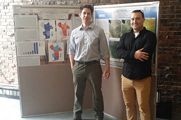
UPPER LEFT IMAGE: Christopher Badurek, left, with Matthew Raymond, an undergraduate GIS major, during a Transformations 2019 poster session on GIST technology. Raymond previously earned a GIS degree from Cayuga Community College.